 EN
EN ES
ES PT
PT TH
TH VN
VN JP
JPChallenges
Urban traffic management stands as a complex puzzle with challenges that continue to intensify. The rapid growth of urban populations, the surge in vehicle numbers, and the intricacies of modern road networks contribute to issues like traffic congestion, inefficient route planning, and increased pollution levels.
the Role of Inertial Navigation
In navigating the labyrinth of urban traffic challenges, technology emerges as a beacon of hope. Inertial navigation, a cutting-edge solution, plays a pivotal role in unraveling the complexities of urban traffic management. It offers a dynamic and responsive approach to vehicle positioning, providing real-time data crucial for optimizing traffic flow and enhancing overall urban mobility.
Importance of Precise Vehicle Positioning
At the heart of urban traffic management lies the critical need for precise vehicle positioning. Traditional navigation systems often struggle in urban canyons, skyscraper-dominated landscapes, or tunnels where GPS signals may falter. Inertial navigation steps in as a beacon of precision, relying on internal sensors to continuously track and calculate a vehicle’s position, speed, and orientation. This granular level of data is indispensable for ensuring vehicles navigate through the urban jungle with accuracy and efficiency.
Understanding Inertial Navigation
Inertial Navigation Principles
Inertial navigation relies on the principles of motion physics to precisely determine the position, velocity, and orientation of a vehicle. Unlike traditional GPS-dependent systems, inertial navigation doesn’t rely on external signals. Instead, it utilizes accelerometers and gyroscopes to measure changes in velocity and angular rate. These measurements, when integrated over time, provide a continuous and accurate estimation of the vehicle’s movement.
Overview
Accelerometers: These sensors measure changes in velocity along the three axes, allowing the system to understand how the vehicle is accelerating or decelerating.
Gyroscopes: Gyroscopes, on the other hand, detect angular rate changes, indicating the vehicle’s rotation in three dimensions.
Magnetometers: In some systems, magnetometers assist in determining the vehicle’s heading by measuring the strength and direction of the magnetic field.
The integration of these sensors creates a robust inertial navigation system that can function seamlessly in environments where GPS signals are compromised or unavailable, such as dense urban areas or tunnels.
Other Navigation Technologies
GPS (Global Positioning System): While GPS is widely used, it has limitations in urban environments where tall buildings obstruct satellite signals. Inertial navigation serves as a complementary technology, offering continuous navigation when GPS signals are weak or absent.
Visual Odometry: Inertial navigation surpasses visual odometry, especially in scenarios with poor visibility. Visual odometry relies on cameras to track visual features, making it susceptible to challenges like low light conditions or visual obstructions.
Lidar and Radar: Inertial navigation stands out in its ability to operate independently of external environmental conditions. Lidar and radar systems may face challenges in adverse weather, whereas inertial navigation remains unaffected.
Applications in Urban Traffic Management
Real-time Monitoring of Vehicle Acceleration, Deceleration, and Turns
Inertial navigation systems play a pivotal role in providing real-time insights into a vehicle’s dynamics. By continuously monitoring acceleration, deceleration, and turns, these systems generate precise data on how vehicles are maneuvering through urban landscapes. This information is invaluable for traffic management authorities and city planners, offering a granular understanding of on-road behavior. Real-time monitoring allows for immediate responses to sudden changes in traffic patterns, enhancing overall traffic safety.
Enhanced Accuracy in Tracking Vehicles in Dense Urban Areas
Urban environments, with their complex network of roads and structures, often pose challenges to traditional navigation systems like GPS. Inertial navigation excels in such settings by offering enhanced accuracy in tracking vehicles. The system’s reliance on internal sensors makes it resilient to signal obstructions caused by tall buildings or tunnels. This accuracy is particularly crucial for applications such as ride-sharing services, emergency response vehicles, and public transportation, where precise tracking in dense urban areas is paramount.
Contribution to Traffic Flow Optimization and Congestion Reduction
Inertial navigation’s ability to provide real-time data on vehicle movements contributes significantly to traffic flow optimization. By understanding how vehicles are interacting with the road network, traffic management authorities can implement dynamic strategies to alleviate congestion. Inertial navigation enables the identification of traffic bottlenecks, rerouting options, and the implementation of intelligent traffic signal control systems. These contributions collectively work towards reducing congestion, improving overall traffic efficiency, and enhancing the urban commuting experience.
The applications highlighted above demonstrate how inertial navigation systems are not only addressing the challenges of urban traffic management but are actively contributing to creating smarter, safer, and more efficient cities. In the following section, we’ll delve into the role of inertial navigation in the realm of autonomous vehicles.
Overcoming Urban Navigation Challenges
Urban canyons, characterized by towering skyscrapers and densely packed structures, often create challenges for GPS signals. Inertial navigation systems excel in addressing this issue by relying on internal sensors rather than external signals. These systems continue to provide accurate positioning data even in the presence of signal obstructions. By mitigating the impact of urban canyons, inertial navigation ensures consistent and reliable navigation for vehicles navigating through these complex environments.
In urban settings, signal interruptions are common due to factors such as tall buildings, tunnels, or temporary signal outages. Inertial navigation systems are designed to maintain accurate positioning even during these interruptions. Leveraging data from accelerometers and gyroscopes, these systems continue to track a vehicle’s movement seamlessly when external signals are temporarily lost. This capability is crucial for ensuring uninterrupted navigation and preventing disruptions in services that rely on precise location data.
Navigating through tunnels and covered roadways presents a unique set of challenges for traditional navigation systems that rely on external signals. Inertial navigation systems, however, prove to be effective in these scenarios. By utilizing inertial sensors, these systems continue to provide accurate position and trajectory data when GPS signals are unavailable. This capability ensures that vehicles maintain a consistent and accurate navigation experience, even in environments where other navigation technologies may falter.
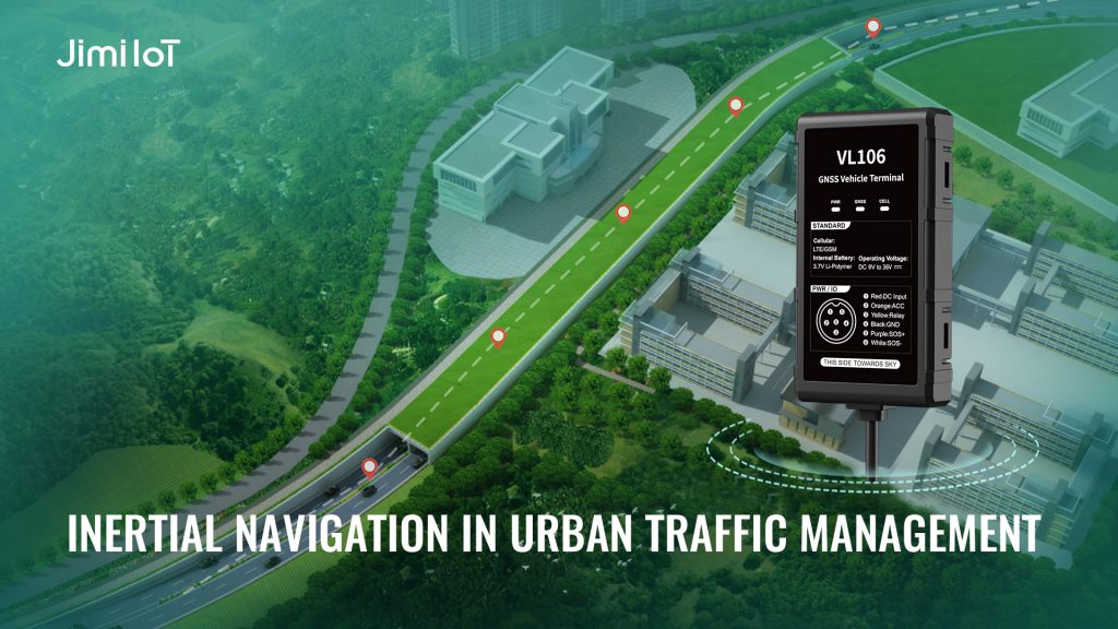
Fleet Management Solutions with VL106 Inertial Navigation System
Empowering Fleet Efficiency with INS Technology
Experience a new era in fleet management with the VL106 INS-aided LTE Vehicle Tracker. This innovative solution combines traditional GPS/BDS/GLONASS/Galileo positioning with Inertial Navigation System (INS) technology, setting a new standard for precision and reliability in fleet tracking.
The VL106 goes beyond basic tracking by offering Advanced Driving Behavior Analysis. Gain deep insights into driver behavior, including acceleration patterns, deceleration tendencies, and turn efficiency. This level of analysis empowers fleet managers to optimize operations, reduce fuel consumption, and enhance overall driver safety.
Collision Detection: The VL106 is equipped with state-of-the-art collision detection capabilities. In the unfortunate event of an impact, the system triggers immediate alerts, allowing for swift response to potential emergencies.
Multiple Alerts: Stay informed in real-time with multiple alert functionalities. Receive notifications for events such as geofencing violations, speeding incidents, and unexpected vehicle stops, ensuring prompt actions to address any anomalies.
Remote Cut-Off (Fuel/Power): Enhance security and control with remote cut-off capabilities. In situations where intervention is necessary, fleet managers can remotely cut off fuel or power, ensuring the safety of the vehicle and its contents.
Panic Button: Prioritize the safety of drivers with the Panic Button feature. In emergency situations, drivers can trigger immediate alerts, notifying fleet managers or authorities for swift assistance.
Ignition Detection: Monitor vehicle usage effectively with ignition detection. The VL106 provides accurate information about engine ignition status, allowing for precise tracking of vehicle start and stop times.
About JimiIoT
JimiIoT is a global leader in innovative IoT solutions. We provide cutting-edge hardware and software tailored to enhance efficiency and connectivity. Our range of products includes advanced GPS tracking devices, asset management solutions, smart vehicle dashcams, and telematics platforms. With a focus on technological excellence and customer satisfaction, we empower businesses to optimize operations and gain valuable insights from data-driven analytics. Trust JimiIoT to drive positive change and unlock growth opportunities in the digital age.
If you would like more details, please visit Facebook, LinkedIn, INS, and Twitter pages to learn more.